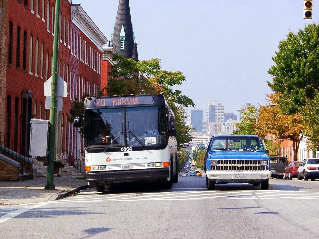
When you think of your typical transit photography setting, what first comes to mind?
It could very well be a fully packed transit bus rambling down a broad thoroughfare amid a densely populated neighborhood, or dropping off people in a cluttered commercial area. It may be a light rail train zipping along heavily graded right of way between stations, or it may be a subway train stopping at a bustling transfer interchange point. Keep those thoughts, please.
For decades, mass transit's primary domain has been moving, well, the masses. Its areas of primary success have been those with large and dense populations of potential customers of modest means. When it comes to buses, due to the size of the vehicles, the noise they create, and the general wishes of neighborhood residents due to these factors, they typically are restrained to mainline arteries. Key word: TYPICALLY.
For many years, I've had a peculiar fascination with the outliers to the the above premise, and have made some effort to try to document these as much as I could. These may have included something as simple as particularly narrow city streets that buses traversed to connect between major arteries, bus service on narrow residential roadways in well-to-do areas, or transit service of any mode in an area that looks like it doesn't have ANY density to be able to support it!
Depending on where you live, the availability of these "fish out of water" situations will obviously vary. In my general area in the mid-Atlantic, such interesting locational opportunities, while never all that prevalent to begin with, have been in an increasing state of decline. The general tendency in most transit agencies is to streamline service, with the focus being increasingly on core service pattern with minimal deviation. As such, one may have to do some particular scanning of the local service information maps and timetables, while perusing Google Street View to scout out possibilities of this sort.
Why tell this story?
One might rightfully be able to argue that since these situations are atypical of most transit operations, their importance should not be artificially inflated. Fair enough indeed, but I'd counter by saying that any story worth telling is worth telling completely. Besides, some of these unusual settings can serve as illustrated examples of the diversity and versatility possible with transit service, even if these outliers may be far from perfect.
Examples:
For the history buffs, the best example of outliers are that of service running on narrow arteries in dense environments in the "Olde City." Service running on belgian block or brick paved streets is a bonus! Composition of such shots can be pretty challenging due to parked cars and other obstructions, and may be best accomplished through a largely head-on perspective.
The following shot doesn't quite successfully illustrate the narrowness of Hughes Street on which the #1 runs, due to my interest in positioning the street paving in the foreground, but definitely makes me feel like I should make a return trip for another try!

For decades, mass transit's primary domain has been moving, well, the masses. Its areas of primary success have been those with large and dense populations of potential customers of modest means. When it comes to buses, due to the size of the vehicles, the noise they create, and the general wishes of neighborhood residents due to these factors, they typically are restrained to mainline arteries. Key word: TYPICALLY.
For many years, I've had a peculiar fascination with the outliers to the the above premise, and have made some effort to try to document these as much as I could. These may have included something as simple as particularly narrow city streets that buses traversed to connect between major arteries, bus service on narrow residential roadways in well-to-do areas, or transit service of any mode in an area that looks like it doesn't have ANY density to be able to support it!
Depending on where you live, the availability of these "fish out of water" situations will obviously vary. In my general area in the mid-Atlantic, such interesting locational opportunities, while never all that prevalent to begin with, have been in an increasing state of decline. The general tendency in most transit agencies is to streamline service, with the focus being increasingly on core service pattern with minimal deviation. As such, one may have to do some particular scanning of the local service information maps and timetables, while perusing Google Street View to scout out possibilities of this sort.
Why tell this story?
One might rightfully be able to argue that since these situations are atypical of most transit operations, their importance should not be artificially inflated. Fair enough indeed, but I'd counter by saying that any story worth telling is worth telling completely. Besides, some of these unusual settings can serve as illustrated examples of the diversity and versatility possible with transit service, even if these outliers may be far from perfect.
Examples:
For the history buffs, the best example of outliers are that of service running on narrow arteries in dense environments in the "Olde City." Service running on belgian block or brick paved streets is a bonus! Composition of such shots can be pretty challenging due to parked cars and other obstructions, and may be best accomplished through a largely head-on perspective.
The following shot doesn't quite successfully illustrate the narrowness of Hughes Street on which the #1 runs, due to my interest in positioning the street paving in the foreground, but definitely makes me feel like I should make a return trip for another try!
Moving outward from the city core, another example shows a full size transit bus traversing a particularly narrow residential street in a moderate density, working class neighborhood:

From the 1940's until 2008, interesting shots such as this were possible in Baltimore on the #11 line, which ran along narrow residential streets in a quaint well-to-do neighborhood, directly past ponds with fountains. Service was then entirely relocated to the nearest main artery.


From the 1940's until 2008, interesting shots such as this were possible in Baltimore on the #11 line, which ran along narrow residential streets in a quaint well-to-do neighborhood, directly past ponds with fountains. Service was then entirely relocated to the nearest main artery.
The following shot doesn't readily illustrate the affluence of the area in which it is operating, though it does give a look far removed from the typical transit environment. I am glad I took the time and effort to get this photo, as service stopped running here in 2005.
And definitely far-removed from the usual urban environs is this shot taken around 2001, in one of the most far-flung parts of the service area. Standing out street-side awaiting this shot to happen definitely turned some heads from the passing motorists. As with the last couple shots, this shot is no longer possible due to service cutbacks.

Though shots like this are admittedly more of a bus phenomenon than a rail one, there are some current examples in our nation's limited rail infrastructure in which both street-running rail systems, and those on private right-of-ways can be spotted in some atypical settings. The following shot shows an extension of the #13 trolley in Philadelphia that winds its way through some narrow residential streets in the Darby area. Though too wedge like in nature to really illustrative (thanks to me rushing the shot), it does give just one example of a rail operation with a unique operating nature. To be said, there are a number of others.

To close, I would like to merely say the following, without sounding alarmist. Never take for granted that the shot you may wish to take today will exist tomorrow. You'll note that three of the six examples shown above are no longer possible to capture, aside from chartering a bus and "posing" them. Outliers like those above a neat, and rewarding way to add a novel amount of variety to your photo collection, and they will certainly be ones that you will look back upon with a feeling of both interest and accomplishment!
Though shots like this are admittedly more of a bus phenomenon than a rail one, there are some current examples in our nation's limited rail infrastructure in which both street-running rail systems, and those on private right-of-ways can be spotted in some atypical settings. The following shot shows an extension of the #13 trolley in Philadelphia that winds its way through some narrow residential streets in the Darby area. Though too wedge like in nature to really illustrative (thanks to me rushing the shot), it does give just one example of a rail operation with a unique operating nature. To be said, there are a number of others.
To close, I would like to merely say the following, without sounding alarmist. Never take for granted that the shot you may wish to take today will exist tomorrow. You'll note that three of the six examples shown above are no longer possible to capture, aside from chartering a bus and "posing" them. Outliers like those above a neat, and rewarding way to add a novel amount of variety to your photo collection, and they will certainly be ones that you will look back upon with a feeling of both interest and accomplishment!